

3D MODELLING

THE DIGITAL TWIN OF THE REAL WORLD
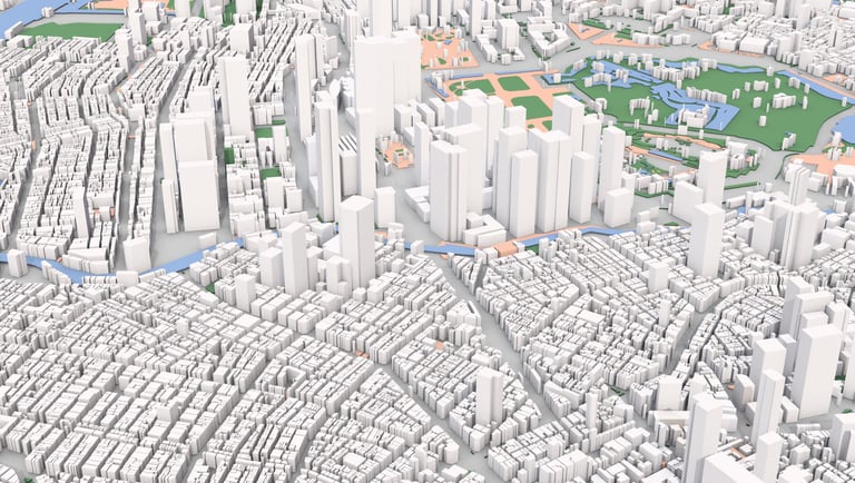
In urban, infrastructure, and contemporary architectural projects, 3D modeling is no longer just a visual tool but an essential technical requirement for decision-making support.
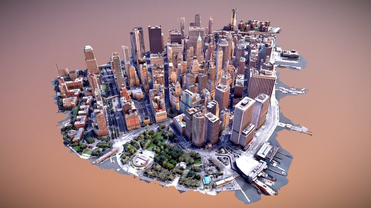
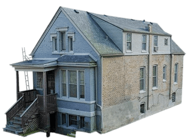
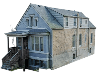
Altivis transforms data collected on-site into georeferenced three-dimensional models, to scale and compliant with standards, usable both for visual presentation and technical analysis.
WHAT IS A GEOREFERENCED 3D MODEL?
It is a three-dimensional digital representation of a site or building, anchored in a real coordinate system.
These models are used for both graphic and analytical purposes, particularly in:
Urban planning
Architectural design
Renovation or urban transformation projects
Energy infrastructures and networks
Altivis combines photogrammetric data, LIDAR, and drone data to create complete and reliable models.
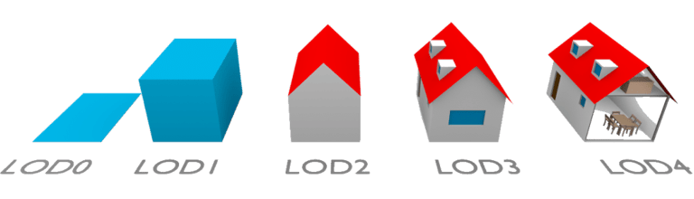
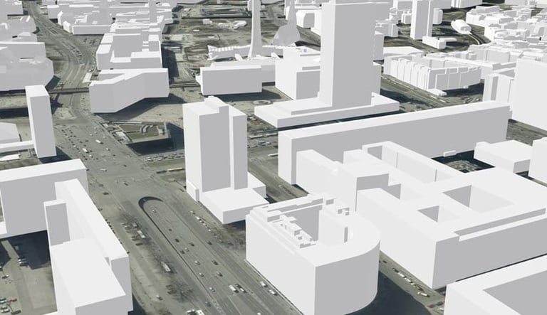
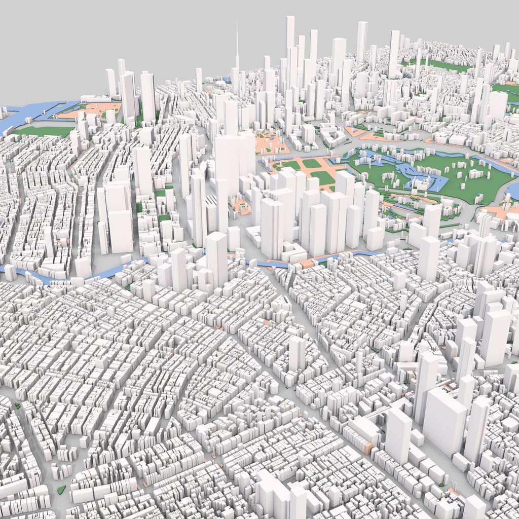
TECHNICAL INFRASTRUCTURE: MESH AND LEVELS OF DETAIL (LOD)
2- Levels of Detail (LOD - Level of Detail)
Models are produced according to different levels of complexity based on the intended use:
LOD0: Building footprint (plan view)
LOD1: Simple volumes (cubic shapes)
LOD2: Simplified roof and facade details
LOD3: Realistic representation of facades
LOD4: Interior of the building (on request)
This hierarchy allows for optimal data management and smooth visualizations.

1- Mesh Modeling
Point clouds are transformed into high-resolution triangulated meshes, faithfully replicating the geometry of the terrain or building. Textures can be added for enhanced visual realism.
INTERNATIONAL COMPLIANCE AND CITYGML INTEGRATION
The 3D models produced by Altivis are not just simple visual representations. They are also compatible with international standards:
Production of data in CityGML format
Compatibility with BIM systems (IFC standard)
Support for publishing 3D web maps
Full integration with Geographic Information Systems (GIS/CBS)
Thus, each model becomes an element that can be integrated into smart city systems, urban management, or strategic planning.

WHAT WE PROVIDE
Acquisition of high-precision drone and LIDAR data
Photogrammetric processing and mesh model production
Delivery of georeferenced models (UTM, EPSG)
Available formats: CityGML, OBJ, FBX, DXF, IFC
Detail levels tailored to your project (LOD)
Optional web model publishing
DOMAINES D’APPLICATION
Urban renewal and development projects
Architecture competitions and 3D visualization
Infrastructure and transportation simulations
Digital interfaces for smart cities
Real estate presentation and communication platforms
Modeling of energy, water, and telecom networks
Boost your projects with Altivis 3D modeling! Accurate, realistic, and ready for planning, design, or presentation.
Contact us today!

info@altivisgs.com
Address
Abidjan / Ivory Coast
Working Hours
08:00 - 18:00
ALTIVIS © 2025 All Rights Reserved