
ELEVATION PLAN
DETAILED AND UP-TO-DATE GROUND DATA FOR YOUR PROJECTS
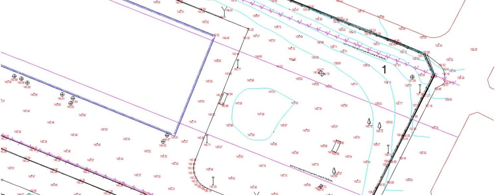
The Contoured Plan is the process of detailed measurement and mapping of the topographical structure of a terrain.
This data forms the first step in architectural projects and serves as the foundation for accurate engineering solutions.
At Altivis, we process the data collected in the field with high precision and prepare contoured plans tailored to each specific project.
OUR SCOPE OF SERVICES
Terrain Measurement with Total Station, GPS, and Drone
Preparation of Contoured Plans at a Scale of 1/100 to 1/1000
Representation of All Natural and Artificial Features of the Terrain
Drawings Enhanced with Elements Such as Elevation, Slopes, Break Points, and Structural Details
Delivery in CAD Format
AREAS OF APPLICATION
Site Preparation Before Architectural Design
Urban Planning and Building Permit Applications
Landscaping and Environmental Development Projects
Site Planning Before Construction
WHAT IS A CONTOURED PLAN?
A Contoured Plan is a detailed map based on measurements that shows both natural and man-made elements of the terrain (slopes, elevation differences, roads, buildings, etc.).
It is an essential component for architectural, engineering, and landscaping projects.
At Altivis, we produce contoured plans using modern measurement equipment and a team of skilled engineers.
info@altivisgs.com
Address
Abidjan / Ivory Coast
Working Hours
08:00 - 18:00


ALTIVIS © 2025 All Rights Reserved