

GEODESY & TOPOGRAPHY
PRECISE FOUNDATIONS FOR RELIABLE PROJECTS
At Altivis, we offer professional geodesy and topographic solutions to anchor your projects on solid ground.
Using rigorous scientific methods, we accurately measure the shape, position, and elevation of the land. This data provides an essential starting point for engineering, construction, and development projects that are perfectly aligned with real-world site conditions.
GEODETIC MEASUREMENTS
At Altivis, we carry out high-precision geodetic measurements, essential for all engineering, infrastructure, or urban planning projects. Using our latest-generation GNSS equipment and robotic total stations, we ensure:
Static surveys for absolute referencing and reliable point networks
Real-time kinematic (RTK) measurements for fast and accurate stakeouts
Seamless integration with the project’s coordinate system (UTM, TUREF, EPSG, etc.)
These surveys allow us to define terrain positions, elevations, and boundaries with certainty, ensuring compliance with regulatory standards and the technical requirements of your project.
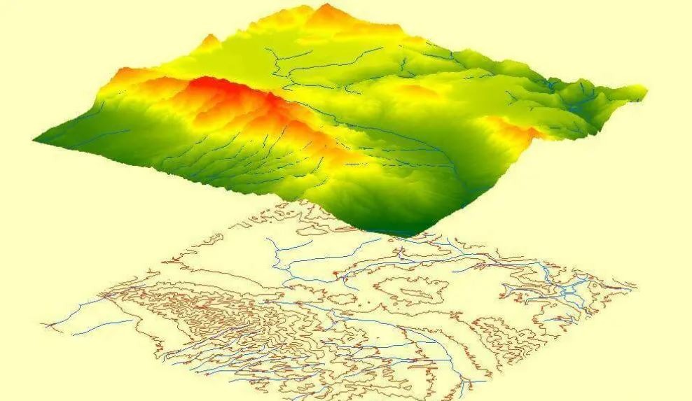
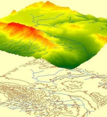
DIGITAL TERRAIN MODELS (DTM & DSM)
In addition to traditional surveys, we produce digital terrain models (DTM) and digital surface models (DSM) using GNSS, LIDAR, or photogrammetric data.
The DTM (digital terrain model) represents the bare earth surface, excluding man-made objects (buildings, vegetation). It is essential for volume calculations, hydrological analyses, or earthworks.
The DSM (digital surface model) includes all visible surface elements. It is ideal for urban modeling, solar shading studies, or visual simulations.
These models are delivered in formats compatible with CAD/GIS software (AutoCAD, QGIS, Revit, etc.), with meter or sub-meter accuracy according to project needs.
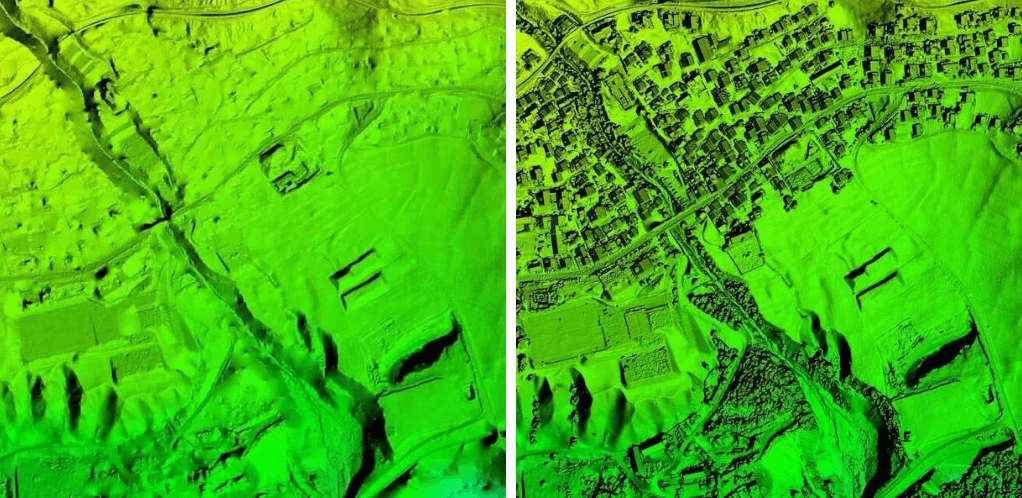
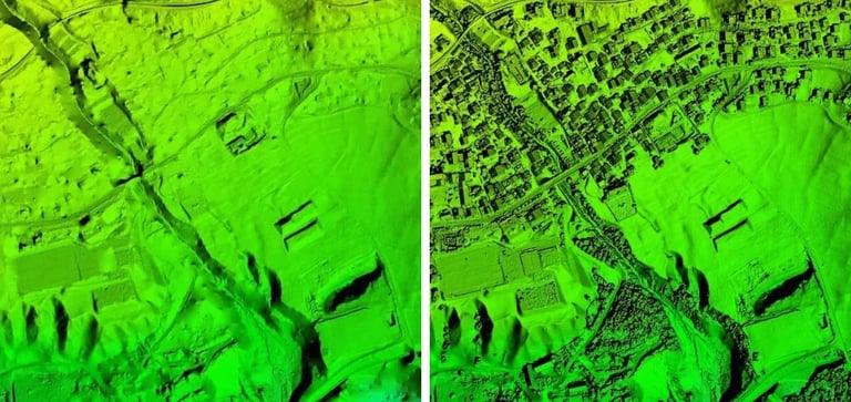
DTM
DSM
info@altivisgs.com
Address
Abidjan / Ivory Coast
Working Hours
08:00 - 18:00
ALTIVIS © 2025 All Rights Reserved