

Geographical Information Systems (GIS)
The Power of Geospatial Data at the Service of Your Decisions
At Altivis, we develop tailor-made GIS solutions that transform raw geographic data into actionable insights for municipalities, businesses, and engineers. Using GIS technologies, we analyze, visualize, and structure spatial information to help you make informed decisions.
WHAT IS A GIS?
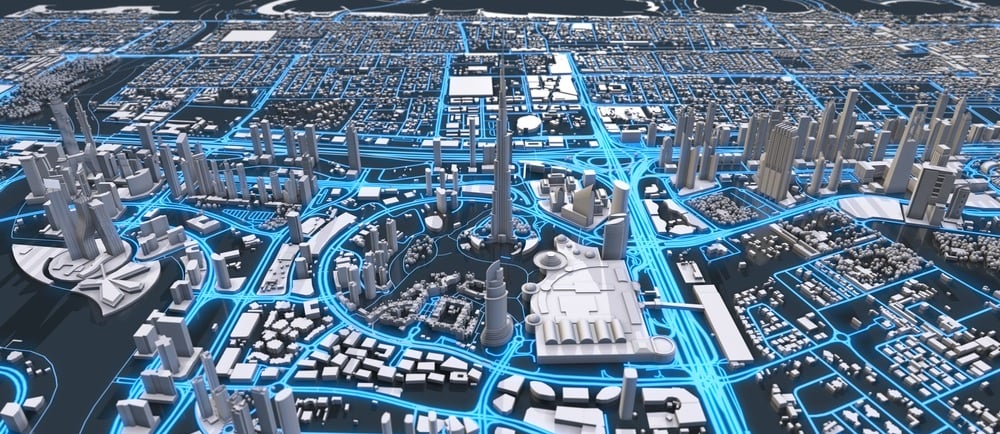
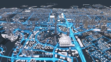
A Geographic Information System (GIS) is a set of digital tools used to collect, store, analyze, and visualize geographic data. Unlike traditional maps, a GIS combines spatial information (location) with descriptive data (databases), providing a deeper understanding of space.
With GIS, it is possible to perform complex analyses, create interactive maps, efficiently manage infrastructure networks, and simulate various planning or development scenarios. It is a strategic tool for municipalities, businesses, and engineers to support informed decision-making.
WHAT WE OFFER
🔍 DATA COLLECTION AND STRUCTURING
GNSS, Drone, LiDAR, and Photogrammetric Surveys
Integration of Existing Data (DWG plans, cadastral information, etc.)
Structuring of Thematic Layers (utilities, parcels, roads, etc.)
🗂️ CREATION AND MANAGEMENT OF GEOGRAPHIC DATABASES
Design of Spatial Data Models
Standardization According to OGC Norms
Hosting on Servers or Cloud Platforms
🗺️ THEMATIC AND INTERACTIVE MAPPING
Production of Custom and Dynamic GIS Maps
Web Mapping Portals (QGIS Server, GeoServer, ArcGIS Online)
Maps for Site Monitoring, Planning, Environment, and More
🧠 ADVANCED SPATIAL ANALYSIS
Spatial Overlays and Attribute Queries
Visibility, Accessibility, Risk, and Zoning Analyses
Urban or Environmental Modeling
APPLICATION EXAMPLES
Infrastructure Monitoring and Management
Urban Planning and Land Use Planning
Land Development and Environment
Construction Projects and Building Permits
Integration with Satellite or Drone Data
Management of Real Estate and Asset
Ownership
WHY ALTIVIS?
✔️ Expertise in both open-source and proprietary GIS tools (QGIS, ArcGIS, GeoServer)
✔️ Seamless integration with topographic, cadastral, and BIM data
✔️ Deployment of tailor-made, turnkey solutions to suit your needs
✔️ Interoperable and scalable maps and databases
NEED A GIS SOLUTION?
👉 Contact us to discuss your needs and turn your data into strategic information.
info@altivisgs.com
Address
Abidjan / Ivory Coast
Working Hours
08:00 - 18:00
ALTIVIS © 2025 All Rights Reserved