

MOBILE MAPPING
Capturing Reality on the Move
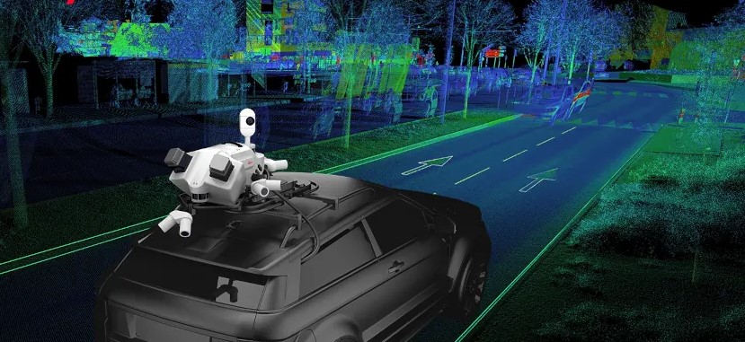
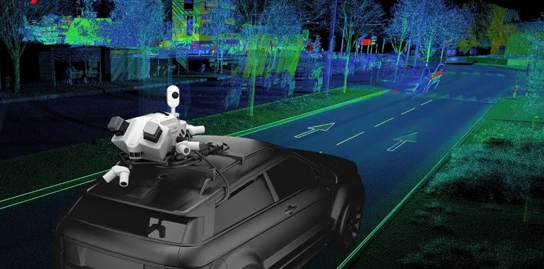
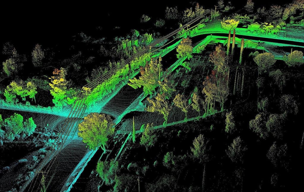
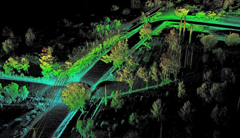
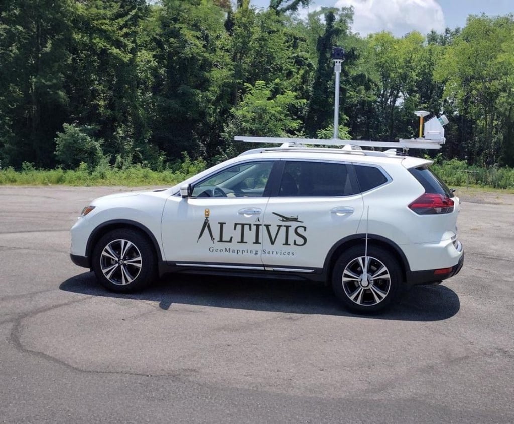
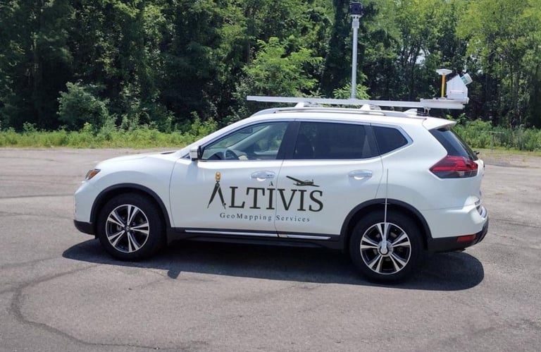
At Altivis, we digitize the environment with high precision using vehicle-mounted mobile mapping systems equipped with advanced sensors. With our integrated LIDAR technology, we generate georeferenced point clouds, detailed 3D models, and 360° panoramic visuals, making them accessible via web-based platforms.
GEOREFERENCING WITH GEODETIC ACCURACY
All collected data is anchored to real-world coordinate systems (UTM, TUREF, EPSG, etc.), ensuring:
Direct integration with BIM, GIS, and CAD systems
Perfect alignment with drone or total station data
A reliable foundation for multiple use cases
WHAT DOES ALTIVIS OFFER?
Mobile LIDAR scanning and panoramic imaging
High-accuracy georeferenced point cloud generation
3D mesh models, orthophotos, CAD-compatible deliverables
Web-based 360° visualization platforms
Delivery in formats like LAS, LAZ, DXF, OBJ, IFC, and more
WHAT IS MOBILE MAPPING AND WHY DOES IT MATTER?
Modern cities and infrastructure systems require accurate and up-to-date spatial data. With our mobile mapping systems, we measure:
Roads, sidewalks, building facades, traffic signs, infrastructure elements
Without interrupting traffic or stopping in the field
At centimeter-level accuracy
— all while the vehicle is in motion.
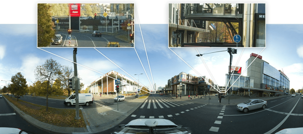
360° STREET VIEW – A GOOGLE MAPS-LIKE EXPERIENCE
Altivis doesn’t just provide raw spatial data.
Using panoramic cameras mounted on our vehicles, we generate 360° immersive street-level visuals. Through Google Street View-style interfaces, users can:
Virtually navigate through every street and corner
Take on-screen measurements
Plan and analyze visually, even from remote locations
APPLICATION AREAS
Road and infrastructure inventory
Smart city and urban transformation projects
BIM-based digital twin modeling
Urban traffic and planning
Street furniture, signage, and lighting analysis
Visual documentation and reporting
WHY ALTIVIS?
GNSS + LIDAR + Imaging = Maximum Accuracy
Full integration with GIS and BIM systems
Easy-to-use web interfaces for non-technical users
Fast delivery of ready-to-use data
WE PROVIDE THE REAL FOUNDATION FOR DIGITAL CITIES
Altivis mobile mapping solutions don’t just deliver data; they enable faster, smarter decisions with digital infrastructure. We bring the field to your desk, supporting every phase of your project.
info@altivisgs.com
Address
Abidjan / Ivory Coast
Working Hours
08:00 - 18:00
ALTIVIS © 2025 All Rights Reserved