

ROAD SURVEYING & DESIGN SERVICES

Specialized Surveying and Support for Road Construction
Altivis provides expert services in the design, supervision, and layout of road construction projects. With our deep knowledge in topographic surveying and the use of advanced technology, we deliver accurate data that is essential for building strong, long-lasting roads that meet all technical standards.
We carry out the measurements needed at every stage of a road project, including:
Plan layouts
Longitudinal and cross profiles
Cut and fill volume calculations
Staking of key design points
These data help engineers design the road precisely and ensure that construction is done correctly on site.
WE ALSO OFFER:
Construction site monitoring
Regular checks to follow progress and detect any issues early.Geometric quality control
Verification of the different road layers during construction.Alignment and elevation verification
Making sure that everything is built according to the approved plans.Technical tracking of project progress
Providing reliable data to support project management and decision-making.
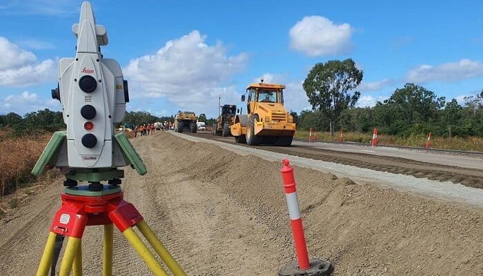
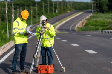
ROADWAY SURVEYING
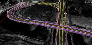
Altivis carries out precise topographic surveys for road projects of all sizes. Using modern equipment such as total stations, high-precision GNSS systems, and drone-based mapping, we accurately measure road centerlines, longitudinal and cross profiles, slopes, curve radii, and cut/fill volumes. This data forms the essential foundation for reliable road design and proper execution in the field.
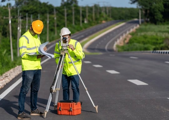
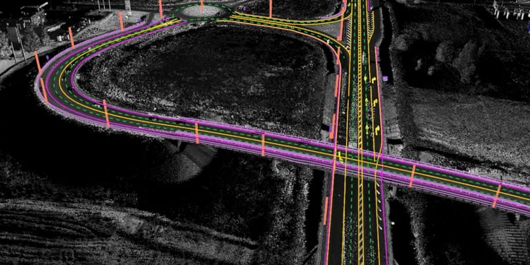
ROAD CONSTRUCTION MANAGEMENT
Altivis also provides technical and topographic supervision for road construction sites. We handle the staking out of structures on site, perform geometric checks of each construction layer, and carry out verification measurements during execution. This service ensures that the built road matches the approved design and supports quality control and progress monitoring throughout the project.
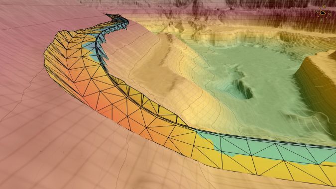
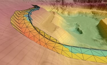
ROAD PROJECT DESIGN
Using the data collected in the field, we create accurate digital road designs that are fully compatible with CAD software and BIM systems. Each design includes the horizontal alignment, elevation profiles, platform geometry, and key elements such as drainage and safety features. We ensure that every project meets technical standards and is ready for efficient execution on site.
From field data to final execution, we support you every step of the way.
info@altivisgs.com
Address
Abidjan / Ivory Coast
Working Hours
08:00 - 18:00
ALTIVIS © 2025 All Rights Reserved